
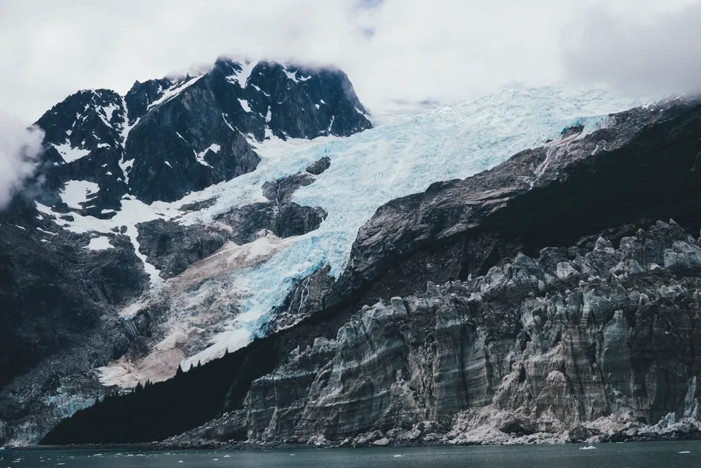

A landslide the size of a small mountain face dropped into an Alaska fjord in August 2025 and set off the second-highest tsunami ever recorded. Now the scientists who studied it say the warning signs were there, and that a monitoring system could have given people some notice.
The wave sent water and debris 1,580 feet (481 meters) up the opposite wall of Tracy Arm, a fjord south of Juneau. That is higher than the top floor of Taipei 101. The research is published in Science, and two of the scientists involved, Michael West and Ezgi Karasözen of the Alaska Earthquake Center, laid out the findings in a piece for The Conversation.
What Happened at Tracy Arm
The slide came just after 5 a.m. on August 9, 2025, near South Sawyer Glacier. Millions of tons of rock broke loose from the mountainside and plunged into the water. The resulting wave stripped the fjord’s walls down to bare rock.
Nobody was hurt, and the timing was lucky. A cruise ship, the Hanse Explorer, had left the area about 12 hours earlier after its passengers photographed the glacier. No ships were nearby when the mountain gave way.
The wave’s height puts it in rare company. The authors rank it as the second-highest tsunami in recorded history. The record, as widely reported, belongs to the 1958 Lituya Bay event, also in Alaska.
The Warning Signs, Looking Back
The researchers reviewed what was happening at the site in the weeks and days before the collapse. Several things stood out:
- A retreating glacier. In the two months before the slide, the glacier below the slope pulled back by more than a third of a mile, with rapid calving.
- Heavy rain. Rain can raise water pressure inside cracks in rock, which makes a slope more likely to fail.
- Warm ocean water. The authors point to warm water and heavy precipitation that August.
- Small tremors. Regional earthquake instruments picked up thousands of small seismic tremors in the days leading up to the collapse.
None of these on its own predicts a disaster. Together, the authors argue, they formed a pattern that a dedicated monitoring program could have flagged.
How a Warning System Could Work
The seismic data in the study came from the state’s regular earthquake monitoring network, not from a system built to watch for landslides. Even so, it recorded the lead-up and the slide itself.
Other research the authors cite shows that large landslides can be detected within a couple of minutes from the seismic waves they produce. Those waves can also help estimate how big the slide was and whether it reached open water.
A three-level alert idea
The authors propose a color-coded scale, yellow, orange and red, that could be issued both before and during an event. Under their approach, an advance alert could go out when conditions look risky, based on things like glacier retreat, heavy rain and rising seismic activity. A faster alert could follow once a slide is detected.
They estimate that a monitoring system might have offered about 10 minutes of warning to people farther away from the slide, and possibly a day’s notice if alerts were issued ahead of time based on the precursor signs. Ten minutes is not much, but it can be enough to move people to higher ground.
Why This Matters Beyond One Fjord
The authors stress that Tracy Arm is not a one-off. In their words, “the conditions that led to this event are not at all unique to this fjord.” Steep slopes above retreating glaciers exist across Alaska’s coast, and many of those waters are busy with cruise ships, fishing boats and tour operators in summer.
For US readers, the gap is plain: “There is no landslide monitoring system operating yet at this scale in the U.S.,” the authors write. Alaska’s tsunami and earthquake alerts are built mainly around quakes, not around rock falling into water.
The Tracy Arm case also sits in a region where the ocean has been warming and glaciers have been thinning. The researchers’ concern is that slopes once held up by ice may become less stable. The mechanics connecting glacier retreat to slope failure are still poorly understood, though, so that link is a research question, not a settled fact.
The Catch
This is a hopeful idea, not a finished system, and the authors are open about its limits.
- It is hindsight. The conclusion that warnings would have helped is retrospective. No monitoring program existed in 2025, so the benefit is hypothetical.
- Predicting where is hard. A warning system depends on knowing which slopes are likely to fail and when, and that is not well established yet.
- Boats in the immediate area get little help. A ship near the slide would have almost no time to react, whatever the system.
- It would take coordination. Building one would require state and federal agencies to work together.
As the authors put it, alert systems “do not remove the risk entirely, but they are a better option than no warning at all.”
What to Watch Next
The practical question is whether agencies decide to fund monitoring for the most exposed fjords, starting with places where large numbers of people travel by boat. Nothing in the sources says that has been decided. If you plan an Alaska cruise or fjord tour, tour operators and the Coast Guard remain your best sources for conditions on any given day.
For now, the Tracy Arm slide is a case study in what the data looked like in the days before a very large event, and in how a regional earthquake network already holds more useful information than anyone was using.
More on Contoh
- Why Does the Moon Have Two Faces? First Far-Side Rocks Point to Earth’s Pull
- NASA’s Perseverance Rover Breaks the Off-World Driving Record, Passing 28 Miles on Mars
- Soil Bacteria Make a “Pac-Man” Enzyme That Eats Bioplastics, and It Can Also Break Down Penicillin
Sources
- ScienceDaily: Alaska’s Monster Tsunami Sent Water 1,580 Feet Up a Mountain
- The Conversation: Alaska’s near-record landslide tsunami sent a wave 1,580 feet up the fjord walls and left clues for building a warning system
- Science: study on the Tracy Arm landslide and tsunami (DOI 10.1126/science.aec3187)